Aerial Surveys for Construction Projects
On a recent redevelopment project, we performed regular aerial site surveys during construction.
As the project progressed the aerial surveys images that we produced became an invaluable asset to client, consultants and contractors. Everyone involved in the project had never experienced the benefits of frequent aerial surveys.
I now looked back on it from a case study point of view and delve into why it was so beneficial to the client, consultants and contractors.
Visibility
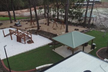
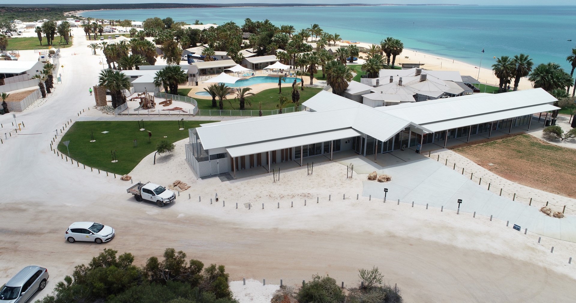
Regular updated single image of the whole development project is a game changer for the client, consultant and contractor.
Instead of getting 100’s of ground level perspective photos of different areas of a project which makes it very hard to get an overarching picture of the complete project, and only getting that understanding of that when you make the site visit.
Now the client and consultants can get a factual snapshot of the project from one single image, that can be zoomed in or viewed as a current 3D model etc.
For the consultant, having a single image that can be used to overlay drawings / plans or zoom in to see what is going on in specific trench or area of the project, have a timeline of aerial images which show the open trench locations which at the end of the project help with obtaining or producing correct Ascons or the images themselves can form part of the Ascon documentation.
It allows for educated changes based on real time information, for example which trees can be kept, what is impact if the road is pushed out .5m to save an established tree etc. Using an aerial image with drawing overlay, these decisions can be made on the fly without having to be onsite
Accountability
Pick up problems before they become a big expensive problem and hold the contractor accountable.
One example on this project was a pit that had been installed in the incorrect location by the civil contractor, the pit was installed in the middle of the soon to be road. This was highlighted when we overlay a drawing on the aerial image, the pit was moved while works were still being carried out in the area.
On projects that I have been involved in previously, all sorts of issues including pits that have been installed in the wrong location, these have required expensive class C or D trafficable lids to be installed because it is too late to relocate. Someone ends up having to pay for the fix.
Process
To produce a aerial survey image we use a drone to take of photos of site, these photos are all done at precise intervals for image overlap and constant height.
Depending on the requirements we often use Ground Control Points (GCPs) to enhance the accuracy of the aerial survey outputs. This requires the use of a couple RTK GNSS receivers, one is used as a base which is placed on a known point (known XYZ coordinates), the other is used as a rover to stake out or deploy points on the site.
The photos are then processed offline to develop a single survey grade aerial image, point cloud, elevation report, plant health report and 3d model.
We can then use these outputs for a multitude of purposes, some of which are detailed above.
What can we do to help with your project
if you have a construction site or a project your working on or existing buildings requiring a roof or solar inspection, we would be happy to chat to see if we can assist.