Aerial Surveys
Using the latest technology we provide our clients survey grade aerial surveys. Aerial surveys are a very useful tool for development projects for checking build v drawings, updating the broader team who aren’t onsite. By using frequent aerial surveys it can save costly mistakes and keep construction contractors honest.
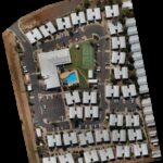
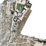
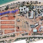
Once the survey has been completed and orthomosaic image created, we can provide the client with various outputs. For example, survey image with site survey overlayed, elevation reports, plant health reports, 3D models etc.
Check out this post on Aerial Surveys in Construction
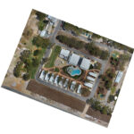
Aerial Photography
Using the latest technology we provide our clients aerial imagery of their property or surrounding attractions. These images are good for Property or Regional Marketing purposes.